Navigating public transportation can feel overwhelming when you first look at those colorful route maps and detailed timetables. Whether you’re commuting to work, exploring a new city, or simply trying to get around town efficiently, understanding how to read transit information is a valuable skill that will save you time and reduce stress.
Understanding Timetables and Route Maps
Public transit systems use standardized formats to present schedule and route information, making it easier for riders to plan their journeys once they know what to look for. Learning these basics will transform confusing charts into helpful navigation tools.
What Are Timetables?
Timetables show when buses, trains, or other transit vehicles arrive at specific stops throughout the day. They typically display times in columns representing different stops along a route, with rows showing departure times. Most timetables use a 12-hour format with AM/PM indicators, though some systems prefer 24-hour military time. The left side usually lists the first stops, progressing to final destinations on the right.
Components of a Route Map
Route maps use visual elements to convey important information quickly. Lines represent the actual path vehicles take, with different colors distinguishing separate routes. Circles or squares mark individual stops, while larger symbols indicate major transfer points or terminals. Numbers or letters identify specific routes, and directional arrows show which way vehicles travel along each path.
Reading Schedule Formats
Most printed timetables organize information in grid format, with stops listed vertically and times horizontally. Bold or highlighted times often indicate key departure points or express services. Some systems use different fonts or symbols to show limited-stop services versus local routes that stop everywhere. Pay attention to footnotes, which explain special conditions or exceptions.
Understanding Timepoints
Timepoints are specific locations where transit vehicles are scheduled to arrive at exact times. Not every stop is a timepoint; many intermediate stops rely on estimated arrival times based on traffic and passenger boarding. Major intersections, transit centers, and popular destinations typically serve as timepoints because they help maintain schedule reliability across the entire route.
Different Schedules for Different Days
Transit systems operate on varying schedules depending on the day of the week. Weekday schedules usually offer the most frequent service to accommodate commuter demand. Saturday schedules typically reduce frequency but maintain most routes. Sunday and holiday schedules often have the least frequent service, with some routes not operating at all on certain holidays.
Using Technology to Navigate Transit
Modern technology has revolutionized how riders access transit information, making real-time updates and trip planning more convenient than ever before. These digital tools complement traditional printed schedules and maps.
Mobile Apps for Transit Navigation
Transit agencies now offer dedicated mobile apps that provide comprehensive route information, real-time arrivals, and trip planning features. These apps often include GPS tracking, allowing you to see exactly where vehicles are on their routes. Many apps also store offline maps and schedules, ensuring you can access information even without internet connectivity.
Real-Time Tracking Tools
Real-time tracking systems use GPS technology to show actual vehicle locations and predicted arrival times. This information helps riders make better decisions about when to leave for their stop and whether to wait for the next vehicle if delays occur. Many systems display this information at major stops and transit centers.
Contactless Payment Options
Modern transit systems increasingly support contactless payment methods, including smartphone apps, contactless credit cards, and dedicated transit cards. These payment options often integrate with mobile apps, allowing riders to purchase fares and track their usage history. Some systems offer discounted fares for digital payments compared to cash transactions.
Accessing Service Alerts
Service alerts notify riders about route changes, delays, or other disruptions that might affect their travel plans. Most transit agencies distribute these alerts through multiple channels, including websites, mobile apps, social media, and email subscriptions. Signing up for alerts on routes you use regularly helps you stay informed about potential issues.
Transit Services and Accessibility
Public transit systems strive to serve all community members, including those with special needs or circumstances. Understanding available services and policies helps ensure everyone can use transit effectively.
Services for Seniors and Disabled Riders
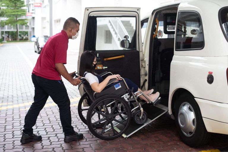
Many transit systems offer reduced fares for seniors and riders with disabilities, along with specialized services like paratransit for those who cannot use regular fixed-route services. When planning your journey, it’s helpful to understand wheelchair accessibility in Japan and similar comprehensive accessibility programs that ensure equal access to transportation.
Policies for Strollers and Pets
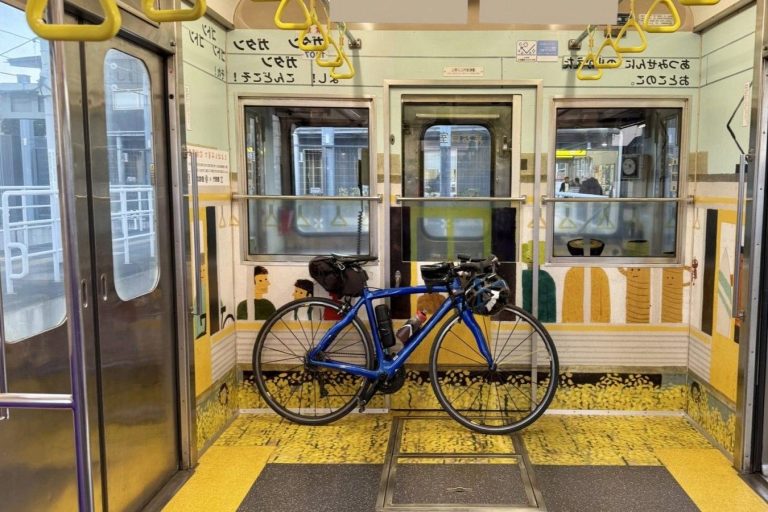
Transit agencies typically have specific policies regarding strollers, bicycles, and pets on vehicles. Most systems allow folded strollers and service animals without restrictions, while pet policies vary significantly. Some agencies require pets to be in carriers, while others allow leashed pets during off-peak hours.
Environmentally Friendly Initiatives
Many transit systems promote environmental sustainability through zero-emission vehicles, renewable energy use, and programs that encourage ridership over private vehicle use. These initiatives often include bike-and-ride facilities, electric bus fleets, and partnerships with environmental organizations to reduce transportation-related emissions.
Accessibility Features on Transit
Modern transit vehicles include various accessibility features such as wheelchair ramps, priority seating, audio and visual announcements, and tactile indicators for visually impaired riders. Transit stops and stations also incorporate accessibility features like raised platforms, tactile warning strips, and accessible pedestrian signals.
Key Tips for Reading Transit Information
Developing efficient strategies for interpreting transit information will make your travel planning faster and more accurate. These practical tips address common challenges riders face when using schedules and maps.
Tips for Reading Route Maps
Start by identifying your origin and destination points on the map, then trace the colored lines connecting them. Look for transfer points where multiple routes intersect, as these often provide alternative travel options. Pay attention to route direction indicators, especially on routes that follow different paths in each direction.
Common Symbols Used in Timetables
Transit timetables use various symbols to convey important information efficiently. Asterisks often indicate special conditions or exceptions, while letters like ‘A’ or ‘B’ might distinguish between different service patterns on the same route. Arrows show direction of travel, and bold text typically highlights major timepoints or transfer locations.
Understanding Fare Information
Fare structures vary widely between transit systems, with some using flat rates while others charge based on distance traveled or zones crossed. Many systems offer day passes, weekly passes, or monthly passes that provide better value for frequent riders. Student, senior, and low-income discounts are commonly available with proper identification.
Using Transfer Points Effectively
Transfer points allow riders to switch between different routes to reach destinations not served by a single route. Understanding proper seat reservation & boarding etiquette at busy transfer points helps ensure smooth connections. Plan extra time for transfers, especially during peak hours when platforms and vehicles may be crowded.
Dealing with Service Changes and Detours
Transit systems occasionally modify routes due to construction, special events, or other circumstances. Knowing how to adapt to these changes helps minimize travel disruptions.
What to Do During Reroutes
When routes are temporarily modified, transit agencies typically provide alternative stops and adjusted schedules. Check for posted signs at your usual stops, and consider using mobile apps to find the nearest temporary stop locations. Allow extra travel time during reroute periods as unfamiliar routes may take longer.
Identifying Closed Stops
Closed stops are usually marked with clear signage explaining the closure reason and duration. Temporary stop closures might direct riders to nearby alternative stops, while permanent closures often coincide with new stop openings in better locations. Always check current service alerts before traveling to avoid surprises.
Staying Informed About Service Alerts
Regular monitoring of service alerts helps riders anticipate and plan around disruptions. Most transit agencies offer multiple ways to receive alerts, including email subscriptions, text messages, and push notifications through mobile apps. Following your transit agency’s social media accounts also provides real-time updates and community discussion about service issues.
Weather Conditions and Transit
Weather can significantly impact transit operations, affecting both schedules and rider comfort. Understanding how different conditions affect service helps you prepare appropriately.
Preparing for Winter Conditions
Snow and ice can cause delays and route modifications as vehicles navigate carefully around hazardous conditions. Dress warmly for potentially longer wait times, and consider alternative routes that might be less affected by weather. Some systems reduce service frequency during severe weather to prioritize safety over convenience.
Safety Tips for Rainy Days
Rainy weather creates slippery conditions at stops and on vehicles, requiring extra caution when boarding and moving around. Bring appropriate rain gear and allow extra time for travel as vehicles may operate more slowly in wet conditions. Be especially careful around bus stops where water accumulation might create hazardous walking conditions.
Impact of Weather on Schedules
Extreme weather conditions often force transit agencies to modify schedules or suspend service entirely for safety reasons. Hot weather can affect vehicle performance and passenger comfort, while severe storms might require route detours around flooded areas. Understanding peak hours, holidays & event schedules helps you plan around weather-related disruptions more effectively.
Engaging with the Transit Community
Public transit creates communities of regular riders who share experiences, tips, and advocacy for better service. Connecting with other transit users can enhance your riding experience and contribute to system improvements.
Connecting with Other Riders
Regular commuters often develop informal networks, sharing information about delays, alternative routes, and system changes. Online forums, social media groups, and community boards provide platforms for riders to exchange helpful tips and support each other during service disruptions.
Participating in Feedback Sessions
Transit agencies regularly seek rider input through surveys, public meetings, and focus groups. Your feedback helps shape future service improvements, route modifications, and policy changes. Many agencies also have customer service departments that address individual concerns and suggestions.
Finding Local Transit Groups
Transit advocacy groups work to improve public transportation through policy advocacy, community education, and rider support. These organizations often provide valuable resources for new riders and advocate for better service, accessibility improvements, and sustainable transportation policies.
Safety and Emergency Procedures
Understanding safety protocols and emergency procedures helps ensure your personal security and prepares you to respond appropriately if unusual situations arise during your transit journey.
Understanding Safety Protocols
Transit systems implement various safety measures to protect riders, including security cameras, emergency communication systems, and trained personnel. Familiarizing yourself with bus safety procedures and general transit safety guidelines helps you travel confidently and respond appropriately to different situations that might arise.
Emergency Contact Information
Every transit system provides emergency contact information for reporting safety concerns, medical emergencies, or security issues. This information is typically displayed prominently in vehicles and at major stops. Program important numbers into your phone and know how to quickly contact transit security or local emergency services.
Reporting Issues on Transit
Transit agencies rely on rider reports to identify and address problems quickly. Most systems provide multiple ways to report issues, including phone hotlines, mobile apps, and online forms. When reporting problems, provide specific details about location, time, and nature of the issue to help agencies respond effectively.
Frequently Asked Questions
What is a timetable?
A timetable shows when transit vehicles arrive at specific stops, typically organized with times in columns for different stops along a route.
How can I use mobile apps for transit navigation?
Mobile apps provide real-time arrivals, trip planning features, and GPS tracking to help riders navigate transit systems more efficiently.
What should I do during service changes or detours?
Check for posted signs at stops, use mobile apps to find alternative stops, and allow extra travel time during reroute periods.
How do weather conditions affect transit operations?
Weather can cause delays and modifications to routes or schedules; it’s important to prepare accordingly and stay informed about service alerts.
What are some safety tips while using public transit?
Familiarize yourself with safety protocols, keep emergency contact information handy, and report any issues you encounter during your transit journey.
Navigating Public Transit with Confidence
Mastering the art of reading transit maps and timetables empowers riders to travel efficiently and safely. By understanding the basics of public transportation systems and utilizing modern technology, individuals can enhance their commuting experience and contribute to a more connected community.